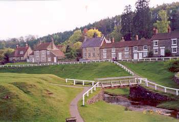
So up at 4:45 for a quick breakfast - not much as I'd overindulged on chicken fajitas the night before and still felt a bit stuffed. Said my goodbyes to a sleepy Clare and I was out the door for about 5:40 (I obviously don't move fast at this time of day as didn't even get a wash in during this time). It was a slow drive up north on minor A and B roads, too-steady drivers ahead and lots of fog on both the East Yorkshire Wolds and North York Moors meaning I arrived at Hutton-le-Hole a liitle closer to start time than I'd hoped. I stuck £4 in the meter of National trust car park for worry-free day long parking and was really glad that the WC was open, no queue for a cubicle and really pretty clean.
There can't have been many more than two-dozen runners at the start briefing, maybe a 7:30 start - even early compared to an LDWA challenge - is beyond most peoples Saturday morning aspirations. We were soon onto the moor, treading the trail gradually up the Hutton Ridge with fog covering the surroundings and anybody who was more than a few hundred feet ahead. Off this path and a bit of a gulley crossing and we soon onto a track following the old railway line which hugs the the ridge side along one side of Rosedale along Blakey Ridge.
My stomach wasn't feeling great, feeling a bit acidic/bloated, I guess the breakfast on top of stuffing the previous night hadn't mixed well with the early start. It was a cold morning in the fog, but the air was still and there was soon evidence of sunlight trying to burn through. The sunny day I'd seen predicted on the Pickering forecast started looking likely to be extended onto this southern part of the moors - though I've learned in the past that moors weather can be very different to that of the towns on the flatter lands around. Whatever the temperature right now I'd got a bit of a sweat on in the early ascending miles in my t-shirt / windproof combination so was looking forward to a drink at CP1.
CP1 was a friendly, but low key affair with cups of water and a top up for bottles if needed. No food here, but we knew not to expect food on the way around. This provision is a bit of a departure from other long distance events I've done where checkpoint food is usually provided, sometimes in great variety and quantity (e.g. Fellsman, Lakeland 100, UTMB and *every* LDWA challenge I've done). No problem though, I'd come prepared with celebration-sized snickers bars, cheap but substantial flapjack bars, beef sandwiches, and tomato/chicken pasta - not to mention the scientific stuff, an energy drink powder refill for halfway and electolyte tabs. Enough to see me around, but not to overly weigh me down.
Onwards down the railway line and the climb seems to peak as it hits a tight right hand bend around what I guess is the northerly extent of Rosedale. This bit of ex-track has certainly not been as extensively restored as the earlier straight bits as we undulate up and down following the bend of the valley. Across a gill and soon after we break into a walk as we leave the railway line and climup onto Rosedale Moor. At this point I'm heading a little group including a dog who seems to be a liitle upset that his owner can't keep up.
As the climb finishes its onto open moor and soon after crossing an improved track we soon hit a right turn on the route which should takes us on a very minor path which nestles almost invisibly under the County parish boundary on the map. At this point I should point out that as well as not providing food on route the other difference to the norm is that unlike most British trail ultra's this is actually route marked. I've only seen this once before and this was at the UTMB where they did an impressive job marking the route with little night-glow posts. Here a similar job had been done by a much smaller organising team using read-and-white riboon tape every few yards on route and in greater quantities at turns. This is great 90% of the time, but unfortunately in mid-flow of running and conversation we did sometimes miss turns on the route or lose it on open moor.
In this case our group just ran off the route somehow, I must take some of the blame for this as I was heading the group at this stage. As the track weaved through heather and crossed a muddy confluence of gills we just lost the true route. Two of us realised quickly that we hadn't seen any tape for a few minutes, but another in the group convinced us we were going the right way, but later admitted he hadn't been this way on the recce. We seemed to be south of marshy land and a gill, consulting maps we found a safe crossing point and continued with the gill to the right. Small paths appeared and disappeared, but consulting the map the only gill marked and slight countour of its banks was heading almost south, when we needed to be closer to east. As I couldn't convince everybody, Mark one other and I decided to head almost north across the heather to try and cross the marked path and refind the route.

On from CP2 and the order of the day was further progression westward. Incidentally, the other members of our former lost band had remerged onto the road where the checkpoint was about a third of a mile south and five minutes after us. Mark and I chatted happily in our usual manner about the merits of the course/day so far, how we were feeling, general catchup and the other subject dear to a long distance runners heart - what the carb-refuel would be tonight. I was going out for a family meal so would be able to really fill my boots on three courses of Italian food.... assuming I finished this 40+ miler and got home in time!
Somewhere along here the track started to turn south as expected, but alarm bells rang again as I could see no route markers on the route and consulting the map the wooded area on the left was far too close, the one on the right too far away - we'd missed a turning. Worse still, although we were running in just a group of two at this point we could see a few hundred yards back that at least two had followed. As I was holding the map at this point I somehow convinced Mark that we should go heather bashing again in a Westerly direction to again reach the correct path. The others behind didn't follow though could definately see that we had left the path, we left them heading off towards RAF Fylingdales.
So, again through burnt bracken, bushy bracken, very boggy, muddy ground and some deep tussocks. I fell over for the second time that day - soaking my remaining dry leg from the first fall - thankfully another soft landing. We hit the 'ribboned' route just before the woods and just in front of another group of people who must have been some way behind us.
Now the Rumble in the Jungle began. I'd mapped the route the previous day and learned then that to add distance over the 30 mile route criss-crossing forest tracks in all directions would make up most of the extra 10 miles. So lots of back and forth in the woods for nearly 15 miles now, but it was mostly good going and enough variation that it didn't get laborious.
Back and forth with the distraction of passing a few hikers and then the local hunt complete with jacketed horseman blowing bugles, energetic beagles and even a bloke one one of those quad bike things tearing up the trail. Away from this Mark and I kept the bloke just behind on his toes by missing turnings just when we were nearly out of yelling range. Mucho cheers for the 2 or callbacks in this section, he undoubtably saved us a mile or two. And eventually we got it into our heads to keep a close eye out for areas of hevay ribbon - marking turns.
Soon we passed through another relative hub of actvity amongst the trees, Keldy Castle cabins. I was suprised just how much the layout and look of the buildings and dwellings was just how I remembered it from a holiday here as a youngster - well a bit smaller. My memory then was the scary noise that kept waking me in the early hours getting seemingly nearer the cabin, I now know this was a pheasent, having scared a few hundred of them as a trail runner, into making that sharp "squawk" as they flew away. Beyond here more miles of trails cut through the evergreen tree's before another campsite and then, finally CP3 as the forest track ran into Moor Lane.
I was glad of the chance to top up my water and energy drink here as it had been quite warm the last few hours as the sun came out and the forest kept any cold air movement out. Half a pot of pasta later and we were stiffly off across the road and back into woodland. Both Mark and I now feeling the miles of the day - including those extra-tough off-piste heather-bashing miles to refind the route in the first half.

This part of the route saw us back in Rosedale, this time following close to bottom, just above the river, arcing north and east. After some rough and sloppy stuff we were soon back on good running surface, but at this point were all walking on any rise longer than a few yards.

The joy of Rosedale went on, after the fairly stiff climb out of Rosedale we now had a gradual descent all the way till we slid off the moor into Lastingham. Dropping off the bank into a little valley, we walked up the other bank - the area looking gorgeous in twilight - and then descended across about half a dozen fields. As we approached the village we passed a course marshall who was putting out glowsticks to mark this bit of route for those still out there. I'd felt after our detours we must be near last, but it turns out this was far from true and others had added far more extra miles than we even had. Into the village and the route took us right back out up a hill onto the moor edge again, but in the direction of H-L-H at least.
Of our earlier group of five the couple had pulled away over the moor and our nav assistant had dropped out of sight behind. But he then reappeared ahead of us having seemingly missed Lastingham - even his nav errors worked out as shortcuts (wish I had this skill). Nethertheless we soon repassed and onto a strong last mile. Back onto the road and just as we approached H-L-H, into the - now dark - woods one last time and dived out a few hundred yards later at the village hall.
A tuck in on some nice thick soup with pasta was our immeadiate reward for 9 hrs and 41.5 miles on our feet. I was pretty happy with that. Then a drive home in the fog (again) and I still got back to Hull in good time for a relaxing bath before all that lovely italian food.
Nice one Danny. Glad to see your back on the longer stuff. Sounded like a grand day out.
ReplyDelete