Friday 16 December 2011

Rudolph-a-rompin', strong wind, and snow in the hills

The title is intended as a catchall to summarise goings on since my last entry.

Rudolph Romp

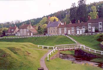
After my mid-November "seeya lata" to long runs - for a few months - at Rosedale the next step was to keep myself in order for Rudolph's Romp a fortnight later. The Romp is an LDWA challenge that welcomes runners and due to what most runners would consider is an overall runnable course there is usually a large and semi-competitive runner turn out. The field dwarfs that of the inaugural Rosedale ultra - over 400 entrants - and is definitely an event that ticks a lot of boxes: inexpensive, runnable, pretty, food-a-plenty and with enough distance and hills to give all a damn good workout. It's also the most local LDWA challenge to me and popular with my running club.

A relatively inactive week followed the Rosedale with a weekend off from running in London. Lots of walking, dodging through crowds and...... ok a short run along the north bank of the Thames and through Southwark offered a different, but not unpleasant backdrop on a Sunny Sunday morning.

The week that followed was little more than running for fun so that I'd hopefully arrive at the Romp in good shape and with the benefits of recent increasing training and a 40 miler in the legs. Knowing the course and having run the 24.5 mile route in 3:48 in 2009 I had a reasonably hard target to aim at.

Those who know the route will know its almost impossible not to run the second half slower. So after a few small hills I settled into a good sub-9 min/mile pace on the flat trails, paths and tracks to Sancton, which is roughly the halfway point and the major on-route food stop.

After leaving this checkpoint after 1:44 I struggled on the next few miles to maintain a similar pace even with plenty of downhills up to about 18 miles - but I was still steadily passing others. The next small climb really kicked a hole in my pace and hereafter the challenging short climbs of the miles beyond 20 was just a case of hanging on. I arrived back at Brantingham VH after being out 3hrs 46mins. Not quite the improvement on my 2009 time I'd hoped for, but an improvement nonetheless. And in 2009 I was coming off an almost injury free summer.

Blowy days

There came some really windy days in the middle of the next week. On a particularly windy Thursday when wind speeds in the Cairngorms hit 165mph it was a little more restrained in the east, but there was certainly a strong wind as the Thursday night club run set out. The schedule for tonight was Humber bridge reps and we decided to stick with it even though it was already closed to high-sided vehicles.

A strong cross and slight headwind was tiring on the way over as we were exposed 100 or so foot above the river with no wind break around barring the slightly elevated car deck. We hoped for a boost from it back, but just as we got up onto the elevated deck again the near horizontal rain kicked in and wind seemed to go up a notch, but mostly pushing us off the bridge rather than along it. Could feel the bridge subtly wobbling below by the middle and a roar as the wind bashed part of the structure on the, more exposed, east side of the deck.....

.... in summary, a great training run :¬) 


Snowy days

Having experienced a mostly mild autumn and winter I learnt a bit more about the winter effects of the Lake District when at about 8am the next morning Mark's car - which I was in - got stuck part-way up the Honister pass. The plan had been to meet Simon at the slate mine, all jump in one car and drive to Wasdale Head to run a leg of the Bob Graham back to Honister. Simon had got here 30mins earlier and attempted to contact us to warn us as he'd got stuck and had to back down the pass too.

We got off the pass after descending back on foot to get grit and back to Seatoller where we decided to run from the National Trust car park and hit a few peaks in a loop. Not far up the pass path and we were running on ice and snow. Beyond the slate mine we headed onto trail towards Grey Knotts and Brandreth. These two bagged we decided to seek lower ground as a wicked cold wind had started blowing snow horizontally. With any true path concealed under between a few inches and feet of snow we made a best attempt to descend alongside Tongue beck into Ennerdale.

We stopped briefly outside the - shut for the winter - Black Sail YHA to take on some food before a warming walk up to Scarth Gap. At the top we turned right to follow the ridge between Ennerdale and Buttermere, picking our way over snow-covered Haystacks and down to Blackbeck tarn. We then diverted north to take in a Final peak for the day at Fleetwith Pike, before heading down to Honister. At first through thick snow, which would support weight then give without warning making for a good few soft landing stumbles and falls... and a few laughs. Then as we found the proper track to the Slate Mine the snow was great, a few inches thick and crunchy so you could run down with confidence and great cushioning.

After getting back to the cars and over to Grasmere we had a very comfortable night in the annex of the very clean and smart YHA. The guy on reception was endlessly helpful and we took up the offer of a three course dinner, which is highly recommended and about the same price as a single course elsewhere in the village. A few beers ended the night.

On Sunday we were up early for a lovely breakfast and off out towards the fells again by 8:30. We ascended past falls along the Gill then a direct route east up to Heron Pike. It was a steep climb and certainly worked off breakfast! Once atop the pike we joined the track which follows the ridge top north. Passing earlier starting walkers we trudged through thickening snow patches and into cloud up to Great Rigg before a slight descent and tough pull up to Fairfield on a track - now completely snow-covered.

Fairfield to Grisedale Tarn was steeper than I anticipated, not helped by slightly melting snow on top of loose stones it was quite a steady descent. The plan was then to take in the small climb up and down Seat Sandal. But seeing snow drifted up as high as the wall top we decided it would be easier to bypass this peak on the way to the descent along Raise beck to Dunmail Raise. Just on the feint track bypassing Seat Sandal we actually encountered the deepest snow we had all weekend.

After crossing the A591 we stopped for lunch before the steep climb up to Steel Fell. This is on the Bob Graham Round route and I could understand from this ascent why winter rounds are so much harder to take on. At the bottom it felt safe enough, but further up on the steeper crags as we climbed across snow on top of scree it got the heart racing a bit! But we were up in about twenty minutes.

From here it was more undulating than hilly for the miles up until Sergeant Man - though plenty muddy and snowing. Coming off here we headed for the Easedale route back to Grasmere as the light was running short. A bit of slow downclimbing at first was followed by some great, speedy rockhopping beyond Easedale Tarn. This gave us a great finish to a fantastic snow-bashing weekend.

A great end to a fantastic trail running year.

Tuesday 29 November 2011

Rumble in the Jungle

Just a delayed report on the Rosedale Rumble 40m distance. After a rebuild of distance over the last couple of months this was still going to be more miles in one go than I'd done in a week since August. Why not though? go steady and muscle memory should see me good.

So up at 4:45 for a quick breakfast - not much as I'd overindulged on chicken fajitas the night before and still felt a bit stuffed. Said my goodbyes to a sleepy Clare and I was out the door for about 5:40 (I obviously don't move fast at this time of day as didn't even get a wash in during this time). It was a slow drive up north on minor A and B roads, too-steady drivers ahead and lots of fog on both the East Yorkshire Wolds and North York Moors meaning I arrived at Hutton-le-Hole a liitle closer to start time than I'd hoped. I stuck £4 in the meter of National trust car park for worry-free day long parking and was really glad that the WC was open, no queue for a cubicle and really pretty clean.

HLH looked very pretty with its foggy draping (pic is one from the web, none of these are my own work as I didn't carry a camera) as I sorted my pack and jog-walked to the village hall start. Met up with Mark Dalton who I would be running with today and also John Steele who would likely be a bit ahead of me. Also, just on leaving to the village edge start, saw Dave Cremins who would be out on the 30m distance, another 26mile-plus distance towards his target of 100 marathon or longer runs (many done this year).

There can't have been many more than two-dozen runners at the start briefing, maybe a 7:30 start - even early compared to an LDWA challenge - is beyond most peoples Saturday morning aspirations. We were soon onto the moor, treading the trail gradually up the Hutton Ridge with fog covering the surroundings and anybody who was more than a few hundred feet ahead. Off this path and a bit of a gulley crossing and we soon onto a track following the old railway line which hugs the the ridge side along one side of Rosedale along Blakey Ridge.

My stomach wasn't feeling great, feeling a bit acidic/bloated, I guess the breakfast on top of stuffing the previous night hadn't mixed well with the early start. It was a cold morning in the fog, but the air was still and there was soon evidence of sunlight trying to burn through. The sunny day I'd seen predicted on the Pickering forecast started looking likely to be extended onto this southern part of the moors - though I've learned in the past that moors weather can be very different to that of the towns on the flatter lands around. Whatever the temperature right now I'd got a bit of a sweat on in the early ascending miles in my t-shirt / windproof combination so was looking forward to a drink at CP1.

CP1 was a friendly, but low key affair with cups of water and a top up for bottles if needed. No food here, but we knew not to expect food on the way around. This provision is a bit of a departure from other long distance events I've done where checkpoint food is usually provided, sometimes in great variety and quantity (e.g. Fellsman, Lakeland 100, UTMB and *every* LDWA challenge I've done). No problem though, I'd come prepared with celebration-sized snickers bars, cheap but substantial flapjack bars, beef sandwiches, and tomato/chicken pasta - not to mention the scientific stuff, an energy drink powder refill for halfway and electolyte tabs. Enough to see me around, but not to overly weigh me down.

Onwards down the railway line and the climb seems to peak as it hits a tight right hand bend around what I guess is the northerly extent of Rosedale. This bit of ex-track has certainly not been as extensively restored as the earlier straight bits as we undulate up and down following the bend of the valley. Across a gill and soon after we break into a walk as we leave the railway line and climup onto Rosedale Moor. At this point I'm heading a little group including a dog who seems to be a liitle upset that his owner can't keep up.

As the climb finishes its onto open moor and soon after crossing an improved track we soon hit a right turn on the route which should takes us on a very minor path which nestles almost invisibly under the County parish boundary on the map. At this point I should point out that as well as not providing food on route the other difference to the norm is that unlike most British trail ultra's this is actually route marked. I've only seen this once before and this was at the UTMB where they did an impressive job marking the route with little night-glow posts. Here a similar job had been done by a much smaller organising team using read-and-white riboon tape every few yards on route and in greater quantities at turns. This is great 90% of the time, but unfortunately in mid-flow of running and conversation we did sometimes miss turns on the route or lose it on open moor.

In this case our group just ran off the route somehow, I must take some of the blame for this as I was heading the group at this stage. As the track weaved through heather and crossed a muddy confluence of gills we just lost the true route. Two of us realised quickly that we hadn't seen any tape for a few minutes, but another in the group convinced us we were going the right way, but later admitted he hadn't been this way on the recce. We seemed to be south of marshy land and a gill, consulting maps we found a safe crossing point and continued with the gill to the right. Small paths appeared and disappeared, but consulting the map the only gill marked and slight countour of its banks was heading almost south, when we needed to be closer to east. As I couldn't convince everybody, Mark one other and I decided to head almost north across the heather to try and cross the marked path and refind the route.

Not to say I told you so to others, but this did work as we soon saw other runners approaching from the west - much of the early mist was now dispersed - and headed on a course to disect their route. Happily we were back on route, probably not too much distance added, but probably a decent chunk of time and energy wasted. Thankfully checkpoint 2 and an unexpected bonus of flapjack and biscuits was not far away as the path crossed the remote moor road. Another bonus was that visibility was better, the sun was breaking through making it pleseantly warm and my stomach had settled down at some point during our moorland meandering.

On from CP2 and the order of the day was further progression westward. Incidentally, the other members of our former lost band had remerged onto the road where the checkpoint was about a third of a mile south and five minutes after us. Mark and I chatted happily in our usual manner about the merits of the course/day so far, how we were feeling, general catchup and the other subject dear to a long distance runners heart - what the carb-refuel would be tonight. I was going out for a family meal so would be able to really fill my boots on three courses of Italian food.... assuming I finished this 40+ miler and got home in time!

Somewhere along here the track started to turn south as expected, but alarm bells rang again as I could see no route markers on the route and consulting the map the wooded area on the left was far too close, the one on the right too far away - we'd missed a turning. Worse still, although we were running in just a group of two at this point we could see a few hundred yards back that at least two had followed. As I was holding the map at this point I somehow convinced Mark that we should go heather bashing again in a Westerly direction to again reach the correct path. The others behind didn't follow though could definately see that we had left the path, we left them heading off towards RAF Fylingdales.

So, again through burnt bracken, bushy bracken, very boggy, muddy ground and some deep tussocks. I fell over for the second time that day - soaking my remaining dry leg from the first fall - thankfully another soft landing. We hit the 'ribboned' route just before the woods and just in front of another group of people who must have been some way behind us.

Now the Rumble in the Jungle began. I'd mapped the route the previous day and learned then that to add distance over the 30 mile route criss-crossing forest tracks in all directions would make up most of the extra 10 miles. So lots of back and forth in the woods for nearly 15 miles now, but it was mostly good going and enough variation that it didn't get laborious.

Back and forth with the distraction of passing a few hikers and then the local hunt complete with jacketed horseman blowing bugles, energetic beagles and even a bloke one one of those quad bike things tearing up the trail. Away from this Mark and I kept the bloke just behind on his toes by missing turnings just when we were nearly out of yelling range. Mucho cheers for the 2 or callbacks in this section, he undoubtably saved us a mile or two. And eventually we got it into our heads to keep a close eye out for areas of hevay ribbon - marking turns.

Soon we passed through another relative hub of actvity amongst the trees, Keldy Castle cabins. I was suprised just how much the layout and look of the buildings and dwellings was just how I remembered it from a holiday here as a youngster - well a bit smaller. My memory then was the scary noise that kept waking me in the early hours getting seemingly nearer the cabin, I now know this was a pheasent, having scared a few hundred of them as a trail runner, into making that sharp "squawk" as they flew away. Beyond here more miles of trails cut through the evergreen tree's before another campsite and then, finally CP3 as the forest track ran into Moor Lane.

I was glad of the chance to top up my water and energy drink here as it had been quite warm the last few hours as the sun came out and the forest kept any cold air movement out. Half a pot of pasta later and we were stiffly off across the road and back into woodland. Both Mark and I now feeling the miles of the day - including those extra-tough off-piste heather-bashing miles to refind the route in the first half.

As we ran out of the forest to the moor road and crossed we were again in amongst a mini-group again as we had congregated at the CP. Five of us crossed the stepping stones, which had been almost overrun by the River Seven (no "R"). The lady of the couple in our group took a tumble into the river here, but seemed all ok. The fifth member of our group, the aforementioned guy who saved us navigationally on a few occasions, ran a bit behind us, suffering a bit at this stage I suspect. It's a small world and we found the man of the couple was another who had completed the Lakeland 100, in a damn good time too. For the lady this was only her second ultra, but she had her eye on next years Lakeland 50.

This part of the route saw us back in Rosedale, this time following close to bottom, just above the river, arcing north and east. After some rough and sloppy stuff we were soon back on good running surface, but at this point were all walking on any rise longer than a few yards.

I didn't realise at the time, but our next bit of mini-civilisation was Rosedale Abbey, well the edge of it, our route didn't quite take us within site of the Abbey itself. With the end now in site and the sun heading for the horizon we got going again quickly, tackling the stiff path climb adjacent to the road up Chimney bank - depending who you believe "the steepest road in England". But we were soon up the suprisingly short climb and onto our last moor of the day.

The joy of Rosedale went on, after the fairly stiff climb out of Rosedale we now had a gradual descent all the way till we slid off the moor into Lastingham. Dropping off the bank into a little valley, we walked up the other bank - the area looking gorgeous in twilight - and then descended across about half a dozen fields. As we approached the village we passed a course marshall who was putting out glowsticks to mark this bit of route for those still out there. I'd felt after our detours we must be near last, but it turns out this was far from true and others had added far more extra miles than we even had. Into the village and the route took us right back out up a hill onto the moor edge again, but in the direction of H-L-H at least.

Of our earlier group of five the couple had pulled away over the moor and our nav assistant had dropped out of sight behind. But he then reappeared ahead of us having seemingly missed Lastingham - even his nav errors worked out as shortcuts (wish I had this skill). Nethertheless we soon repassed and onto a strong last mile. Back onto the road and just as we approached H-L-H, into the - now dark - woods one last time and dived out a few hundred yards later at the village hall.

A tuck in on some nice thick soup with pasta was our immeadiate reward for 9 hrs and 41.5 miles on our feet. I was pretty happy with that. Then a drive home in the fog (again) and I still got back to Hull in good time for a relaxing bath before all that lovely italian food.

Sunday 30 October 2011

Oktoberfest

Isn't October just the strangest month? Sure, we have none of the freezing conditions or snow of December to March (or these last few years seemingly November and April), none of the long and sometimes hot days of May to September. But wait, 30c on October 1st! Frost overnight the week before last, strong wintry winds and a proper soaking for me during last Thursdays club speed session.

It's transition time, in summer I can usually just pack a tshirt, shorts and windproof for a normal outing; in winter, tracksters, underlayer, windproof and/or waterproof top. October it seems anything goes and I've found myself wearing most of the above kit in some combination and packing all of it. Its quite pleasent really though, reminders of whats passed and also a taste of whats to come. Afterall I like winter running, with the right kit, motivation to train big-miles for a new years events and christmas overindulgence to run off why should cold weather be so bad? My biggest mileage month ever was January 2010 and there was no shortage of snow then. "Bring it on!!" I say

For me October comes to a close on a conservative high. I'd ended September tentatively upping mileage following a sprained ankle. I'd missed out on the Hardmoors 60, which was disappointing, but would have been running suicide - undulating coastal trails, stony, uneven, possibly muddy - on a weak joint. Then fate intervened to give me a diahorrea overnight before my first planned event of October. Weak as a kitten the next day it was another DNS, this in the excellent Hope Moors and Tors 20 - with its superb event-signature climb of Grinds Brook clough that always excited me so much in my first few years of trail running.

Not a good start, but back to harder training with the club on Thursday nights and the second weekend in the month saw the start of the Cross Country season. Over the tough trail loop on the Wolds-edge course at Bishop Wilton I set out a good effort. Not tiring too much into the last few miles I was happy, if a bit pace-less.

So back to it next week with back-to-back-to-back sessions before a mini-break in Rome. Great place for a break, loads of walking between sites had me appreciating the lack of a massive underground transport system like in so many big cities. The next weekend I joined Clairster to bag 25 miles at the John O Gaunt 25m LDWA challenge. A lovely scenic and undulating event around the Resovoirs of Nidderdale. It wasn't easy, the great LDWA catering (as nearly always) got me through as the legs felt stiff and sore from about 15m onwards. But with these miles in the bag, I felt I'd given my body the awakening it needed.

This last week has been better still, a few short runs focusing on technique then the first Thursday speed session of the month where I felt I was getting pace and stamina back. Saturday morning came and I was pleased to knock out an 18m+ local, undulating to hilly route in less than 3 hours, can't recall when I last did that kind of pace on any off-road route without absolutely bashing my pan out.

Roll on November, its going to get cold, thats innevitable. But, things are looking up for the Rosedale Ultra 40 miler in three weeks time. A new event to enjoy and a distance I couldn't have done this time last year whilst I was still recovering from injury (another small victory) :¬)

Thursday 15 September 2011

Injury, self doubt and 60 fantastic miles coming soon?

Call me a wimp, but I didn't want to write a more thorough report of what happened at the UTMB. It was such a great atmosphere pre and post race and at times great fun taking part. A lot of the detail isn't reflected in my 'picture tour' blog entry before.

The eventual end to my event was pain slowing me down and tiredness making my progression unsafe. I think without the combination of the two I could have got on ok. As it was after losing loads of time on my ultimate stage, cooling down too much and just making a cut off at Arnuva it would have been foolish to go on and attempt Grand Col Ferret. Maybe with a few strong coffees and a bout of 'runners high' I might have made the next cut-off, but it may have just been several miles of misery and the further ruining of what had been a great experiance for the most part.

So injury, I mentioned this was a factor in my UTMB performance. The sore knee seemed to disappear almost straight after stopping. The ankle was worse, distinct swelling a few inches above my foot at the front of my ankle afterwards. I might have been ok with pain management during the event. But the aggrevation mentioned in my post-UTMB blog, catching my toe on a tree root or planted stone before Refuge Bonnetti, really didn't help. I was running along, not knowing what was causing the pain, whether it was serious or not.

After the event, with RICE, the swelling and pain both went. All was looking good, but then last Thursday on my first hard outing since - 13 days post-UTMB - I was burning up local hilly trail, pushing hard on the 7 hills route that my club regularly run in training. I was well up in the group of club runners, I'd regrouped twice, but then ran straight on as others stopped for another regoup - only one descent and ascent from the last... stopping would have been lazy. I was feeling pretty good, I felt I could tackle the remaining 3 hills in one blast at pace without too much hardship.

Then it happened, slam! So fast.... descending fairly steeply, but at controlled pace, I landed on the outside of my ankle and it rolled over so fast I didn't, seemingly couldn't, react to prevent a sprain. I held the fence, grimacing as others went passed. I was offered help but I said I'd "run it off", in reality this didn't feel like something I could run off. I ended up limping back several miles to the start point, via a road shortcut, somebody kindly picking me up as soon as they'd finished so my pain wasn't prolonged.

I'd sprained my ankle, probably not badly, from Internet research it looks like 'bad' grade 1 at the worst. I visited the doctor the next day, who didn't seem concerned enough to even examine my claim (maybe I didn't look "pained" enough?), but he did prescibe some heat rub and a tubigrip bandage. The combo and innactivity have helped. I even ran a few miles this Tuesday - probably too soon - but I felt good, ableit at very slow pace on very flat ground in a very supportive road shoe. And the a similar distance tonight, but slightly faster.

The mental aspect - self doubt - is something I really need to work on. Why have I retired after roughly 60m of my last two 100's. I'm not overly bothered that I didn't complete, 60m is good distance but I would like to have and wonder if some mental weakness is just jumping on convenient excuses, making pain and tiredness (both muscular and sleepiness) bigger issues then they actually were? Maybe thats an easy presumption in hindsight and now the reality of the moments is a somewhat hazy summary in my mind. Was UTLD 2010 a fluke? Am I not prepared to work that hard, suffer that much again. The answer seems to be, right now..... yes. I have no guarantee of improvement every time at any distance even if I've trained hard. So when you factor in the mental battle of a 100, the miles may have been run to prepare my legs, but were they in my head. Or am I just overthinking this?

There is no clear answer. But it seems sensiblethat I change something and that something would be to back off from and remove the 100mile obstacle - respect the distance (and the big hills). 100 is just a big number in terms of miles, but 60 is still a good one, 79 was also a good one when I completed the Wold's way unaided a few months ago. So I figure I'll bring in a three-figure mileage embargo for 2012, see how that goes. There are some great events that must be classified as long, tough ultra's I can test myself on, but are 99.9 miles or less.

How about the Hardmoors 55 (March) to start with, it's got a deceivingly easy opening 22m, which in two attempts has lulled me into an over-eagerly paced start. I can do better here, a great first long ultra of the year.

Then a step up to the Lakeland 50. Even with the 100 on offer by no means am I shirking if I train hard and do this one justice, finishing before the sun dawns on Sunday (e.g. sub 15 hours or so).

And how about the TDS (Sur les Traces des Ducs de Savoie), the tough little brother of the UTMB at 70-or-so miles. Ok, so its shorter than the UTMB, but it packs in more elevation change per mile, a tougher 70m is hard to imagine.

A return to the Fellsman is also a must, even if they move the date. The Woldsman will be a good substitute in the space between Hardmoors 55 and Lakeland 50.

Before all this I hope I have the potential to complete 60 fantastic miles in the inaugural Hardmoors 60. It will be a joy to run along this part of Yorkshires undulating, hilly and often wild coast and to complete the course would be a 60 mile run I could be very satisfied with. And satisfaction that I can still complete a long event. Here's hoping the sprain keeps healing quickly and I can have a steady and safe saunter around this one.

Wednesday 14 September 2011

Gremlins !!

I seem to be having some issues posting comments on others and my own blogs. So I'm not ignoring any comments or questions on mine and also would like to comment on some of the fine blog posts of others I've read of late. When I get a spare few minutes I'll try and use my IT skills (hrmmpphh!) to get back my accustomed level of access.

Saturday 3 September 2011

An Ultra Trail experiance of Mont Blanc proportions


The UTMB didn't quite work out for me. After around 59 miles of huge ups and downs - both geographically and emotionally - and nearly 24 hours on my feet I threw in the towel at Arnuva, giving in to the urge to sleep that had plagued me since the first night - and had made the last few 3 miles on a narrow hillside path dangerous and slow. Not an issue I'd had before on overnight runs, well not this early on an event anyway. Apart from this I also had sore left knee and sorer and swollen left ankle, which had already slowed me and may well have stopped me if the tiredness hadn't. Here is my picture tour....

At the start, 6 hours later than expected as the start was delayed to let a weather front clear the mountains (risk of electrical storms). A wise decision by the organisers, but it was still raining steadily at the start so full body waterproofs were the order of the day.


Fuzzy action shot of headtorches down the valley on the second and longest climb on route, approaching La Balme CP (1706m).


A pause for pictures (and breath) at Col du Bonhomme (2329m). My legs were hurting, breath was short, clumsy legs, headache and I was almost falling asleep on my feet. Probably too low down for altitude sickness so guess it was an effect of lack of sleep. A few disturbed nights sleep in preperation and not being able to get sleep in the day before the delayed start.


Descending back below the clouds from the highest point on route so far where snow had been falling in a cold wind at Refuge Croix du Bonhomme (2443m). I'm still wearning the full waterproofs I've been wearing since the start and three layers on top, which will all stay on till Les Chapieux.


After a refuel at Les Chapieux (50km / 1549m) I struggled to get going beyond a steady walk on the steady uphill road to Ville des Glaciers. A cold wind started so I sheltered behind a building to get the waterproof top back on and have a quick sort out of myself, including ibuprofen for a painful knee and ankle which had steadily developed since the first climb and descent. When I got going again the head was down as I marched uphill. Suddenley I realised I was passing people, not just a few either, everybody within site I strode past on the ascent of Col de la Seigne (2516m) - pictured.

Spectacular peaks in the gloom pictured from Col de la Seigne.


Aiguelle des Glaciers, viewed from the path down to Lac Combal (65km / 1970m). The descent - one of the less technical - was going pretty well despite my uphill march slowing a bit towards the top of the previous ascent.


Looking back up Col de la Seigne.


Spectacular, Aiguelle des Glaciers. On the way up to Arete Mont Favre (2435m).


A long way down to Courmayeur (78km / 1200m). The route had already dropped nearly five hundred metres to Col Checroiut. Upon leaving here it was a further 756m in less than 5km to Courmayeur and the halfway food checkpoint and drop bag pickup. It was also now warming up, but on the dusty switchback path down the hill I was having fun.


After a 45+min stop in Courmayeur we faced a challenging switchback climb upto the next Checkpoint at Refuge Bertone (1959m). It felt difficult in the evening heat and with a larger meal to digest. But by the Refuge we were high enough to be exposed to cooler winds again.

The next few miles to Refuge Bonatti were undulating rather than hilly. No major problems for me except when I caught the toe of my left shoe on a branch as I lifted it pulling the foot to a fuller flexion than my sore ankle could cope with, exascerbating the left ankle pain. It was dark by the Refuge. I realised just before leaving that I was again rather too close for comfort to the cut off for Arnuva. My compromised pace and spending a bit too long at recent checkpoints to blame. As I started to fight sleep demons again, dozens of eventers passed me on the route to Arnuva, this 5k taking me over one-and-a-half hours. Time to call it a day! @ 95km / 5558m climbed.

I slept on the bus, then at Courmayeur where we were dropped and had to wait an age for a pickup. I got back to Chamonix at about 3am and slept a further 6hrs30 on a campbed in the peaceful gym at the race HQ area.

Its too early to decide if I'll return next year. But after a complete shut-out of finishes in the 100m+ distance this year I'm tempted to take focus of this distance and work on the mid range between the 30-somethings I'm pretty comfortable with and the 100m distance. After various leg and ankle issues this year I think I need a for now rest anyway. At least until the Hardmoors 60 in late September anyway.

A 'maybe' plan looking forward....
Sep - Hardmoors 60
Oct-Feb - 20-30m events
Mar - Hardmoors 55
Apr - Woldsman (50)

May-Jun - a few 30m+ events
July - Lakeland 50

Aug - TDS (Sur les Traces des Ducs de Savoie) (70)

Tuesday 23 August 2011

How to recover from a Mountain mauling?

Lakeland 100

It's been two-and-a-half weeks now, but seems like a strange dream, that I was out there for attempt two at the Lakeland 100 (really 104'ish). It was even all going well for a while. Despite a plan to start off steadier and hopefully have more in the tank for the second half I was actually consistently picking up a few minutes per leg - upto 1h our up. But then it was over, after about 18 hours, almost no time really.

So back to the day. Start steady, afterall the first stage over Walna Scar pass is no picnic at all. And only seems the easiest of the sojourns over 2000ft due to lashings of glycogen and adrenalin coursing through the bodily systems. Concentrating on not running much of this stage, even some of the slighter uphills, and then taking it steady on the sometimes technical descent worked well enough. At CP1 I was a six minutes or so slower than last year. Running with Mark Dalton and Simon Webb, we figured this a safe start.

I reckon it started going wrong for me just after we left Seathwaite. I'm pointing my finger of blame at the good conditions underfoot - not an excuse you would expect eh?. Stage 2 has half the climb of 1 in a similar distance, but passes some of the wettest, muddiest ground I've experianced on pathed/tracked land. Except this day, barring some permanently soggy ground in what is effectively a marsh crossing, it was pretty dry. Apparently it had been a fairly dry few weeks before this event. This made it very runnable and a route change probably made this stage easier. I arrived at CP2 feeling good and already up on last years mark.

Progression was similar over to Wasdale Head and as per last year we arrived high above the lake with enough light to tackle the descent and footpaths to Wasdale Head without a headtorch. Up again.... feeling ok.... but can't help thinking this isn't good. I'm just getting swept along, running where I thought I should, or Mark and Simon were and walking where I had to. I'd discussed with Mark the Stuart Mills idea of running "as fast as you can for as long as you can", but had told myself I would use the cautious approach, which I now wasn't.

The first brute of a stage is Wasdale to Buttermere. Lots of time spent walking, firstly up and over Black Sail pass and then the ascent to Scarth Gap. Couple this with a techical descent on an often invisble path to Ennerdale and a very hard, rocky, slow descent from Scarth Gap and you only get about two miles of good running ground in the dale bottoms. Somehow though, despite walking the same bits as last time - we were again up! Not single figures now either - over 20 minutes.

This pattern repeated through to Braithwaite on the long continuous climb section with a finishing few miles descent. Several groups of competitors merged together here as often seems the case on a long ascent. Amongst our new team was Nick Ham, who had been changing places with use throughout the event so far. Nick, Mark, Simon and I must have been going ok as we broke three of the group heading into Braithwaite. Stiffening a bit now, but I'm sure I felt worse last year AND now 32 minutes up.

After a good feed up I left the CP with Mark and Simon, but then couldn't match their pace on the roadside section. They actually made a slight detour on the route, but were going well enough such that I didn't make contact again until I caught them in a group on the climb up to the Blencathra out-and-back horseshoe. Being up on last years time was evident now as I'd turned the headtorch up at the bottom of this ascent last year. This bit is quite runnable, but I couldn't run it all. I was struggling to keep pace with mark and Simon by the Blencathra centre. My run just wasn't up to theirs and perhaps I should have revisitied plan A and slowed down about now? 40 minutes up and it was great to look down on the lower land blanketed in morning mist.

The next section is nothing if not a chew, flattest section yet, but much of it is on the dreaded, stoney as you like, Drovers road. Simon was flying and Mark was with him so I kept going along at my comfortable run pace. I could see them both and Nick up ahead for much of this section, edging ahead. My run seemed slower than that of all around right now. But I kept good pace with others by running as much as possible. Somewhere towards the end of this section I was starting to think I was exhausted and the possibility of retirement had become enticing. I was quite suprised to see I was now 59 minutes up on last year.

I talked to Mark at this CP and told him to push on and that I would be taking this section easier. As I walked away though, I felt stiff, tired and was battling over whether I should give up at Dalemain or not. The demons won quickly and I walked much of this section having all but give up. I retired soon after arriving at Dalemain. I felt crap, but how much of it was mental and how much physical. I'm a little shocked now, writing this and thinking back I didn't have a slow decline. Just like that I'd given in.

The day was now pretty warm and I proceeded to sleep most of the way back to Coniston. I then slept a further hour or two in my tent, consoled with other retiree's and visited the race HQ to have some dinner, track progress of others and watch the early finishers in the 100 and 50. I then slept a good 9 hours in my tent. I'm sure I've never slept so long in a tent.

This 'brought forward' recovery and only 59m in the legs meant that I awoke on Sunday feeling pretty good. Perhaps the first good thing to come out of this early retirement.

Long Tour of Bradwell

After struggling during this event and getting injured last year with two weeks to recover from the 100 I hadn't even entered this years event which was just a week post-Lakeland. But the Monday after my 59m misdemeanor, I felt suprisingly good and also that I needed a positive long run experiance with just 3 weeks to UTMB. I didn't want to go in on the back of a disappointment. I looked online and entries were still open for the LTOB, despite supposedly closing a few days earlier - surely a sign.

During the week I was sparing on my, suprisingly fresh-feeling, legs. I arrived at the start line of this low-key ultra feeling optimistic and ready to enjoy, work hard and enjoy some of my own kind of self-help therapy.

I got my dibber, much like the previous week at registration, but apart from that the start was a more low key affair than at Lakeland. The Lakeland event has grown quite quickly, with its challenging and interesting route and a growing reputation as a very friendly, supportive event, to 800+ 50 and 100 mile event entrants. The Bradwell event is a year younger, entries possibly suffer a bit for its calender proximity to the Lakeland events, but also offers its own interesting and challenging, rollercoaster route and everything else the non-fussy ultra runner needs for a good day out too. With a few tweaks it could become very popular in the next few years.

Off at 9, nearly starting in my jacket on this chilly morning. The route is pretty quickly onto a slight rise then drop through the cement works - unfortunate centrepiece to all the valleys views - where runners were warming up fast. Then onto a runnable track climb before a drop through the intriguing and slightly slippy rough-hewn rocky steps of Cave dale. A dib and drink in Castleton and were out of town again for the first sizable climb up to Hollins Cross. Straight down the other side and its over fields and tracks to Edale - dib and stop for drink and biscuits - then an even bigger climb - with switchbacks - to Ringing Roger and beyond to a Dib up high - in the clouds as per last year - at Druids Stone. Then its a very direct route off Kinder, down through heather, then along a stone wall back down into the valley. With another climb soon to come its a really hard start making excellent use of the compacted, natural, peaks of the area. And the halfway distance is still some way off.

Onto a brief section of road and under the railway line and were soon heading back uphill again. I seem to have put some space on a large group of runners behind me on the last descent, but many are soon with me again as they seem to have more attack on the uphills onto the mid-valley ridge to visit Back tor and Lose Hill before a longer descent and the longest flat section yet to Hope and a welcome checkpoint to have a drink and refill a bottle.

Feeling a bit tired from that opening mountain mauling the large group behind pretty much all pass me as I take awhile to get going up again in several stages to get up to the ridge at Win Hill. About now it starts raining at a steady rate. Dibbing up top, its now a descent to the half-way'ish checkpoint and 5 hour cut off. Its not an easy cut off by any means, I've taken quite an aggressive approach to this front-loaded event and this didn't work well for me the previous week. But after a flat section I work hard to run along, yet still lose ground on others, I dib in at 3:55. The route description would have it that this was 27km (16.8m), but I know the route and description hasn't changed from last year and its was marketed as 31m total then too, I can add 2 or 3m to that.

I consider putting the waterproof on as the rain is a constant rythm now, but think positive and decide tom reevaluate if it keeps up longer. I was right to, it soon stops and the sun comes out for much of the last third. I'm slow from this checkpoint, but catch three others who are struggling with navigation. I do feel a bit for them as the route description is brief compared to many an LDWA event and certainly the Lakeland 100 with its waterproof, plastic comb-bound roadbook. This coupled with some extremely obscure dib point locations in the second half adds an unusual navigational challenge and those returning to it like me, know they've gotta be on their toes. I think this may bother some people who say this is meant to be a running event, not orienteering. But for my two-pence, I quite like the originality and know that I know what to expect.

Another descent and a bridge, come stepping stone, crossing of a river with an unusally located dib point at the central refuge. Then is through a village to the toughest climb of the day and perhaps the last long one. The first stage foes up Bamford clough, an often arrow straight steep climb on rocks and sometimes slippery smooth stone. Pretty much unrunnable by all I'd have thought. After this long climb there's a bit of undulating road before the climb recommences up to Stanage Edge.

I pass the couple who I'd earlier helped with nav as they had overshot the dib point 2/3 the way up the path from road to Stanage Edge. Easily done, its about 20ft off path, partly obscured by foliage on a stile. As I get to the top I recommence running and find some energy for a steady jog most of the way to the next dib point.

Here I stop for a drink and a few people who are looking a bit stronger pass me by as I walk down th path nibbling on biscuits. I get going again on the good, level, path which runs in a big arc beneath burbage rocks to drop to Toads mouth bridge. This seems to be the most popular of the three route choices. Last year I took the scenic valley bottom route, more interesting, but also more tiring. Next year I guess I take the third option via Fiddlers Elbow - wonder how it got that name?

Anyway at Toads Mouth bridge there is another Comedy dibbing point. 15 foot off the track down a steep riverbank hanging from a tree branch almost over the water. Kind of kills the running momentum from the last stage and obviously causes problems for the unitiated, three runners who must have been a good 3-5minutes ahead of me were just leaving.

More flat-trail fun along a pleasent green section along a stream, the last few miles have been a nice respite from the near constant hills of the first 20+ miles. Navigation gets tricky again as I follow a very indistinct path marked with occasional ribbon away from the riverbank over a bit of moor and into a plantation. Another runner catches me and asks if were near the next CP. I reassure him its still ahead, only 90% sure myself. After dibbing at a gate the route drops steeply down a small bank. The aforementioned 3 runners were at the bottom and had missed the CP so I directed them back on route. They didn't seem that chuffed to have to climb the bank.

I pushed on down to the river chatting with the runner who caught me at the last CP. Turns out he was another who had completed Lakeland 100 in 2010. Having not done it this year he certainly had more in the tank than me and pulled away on the flat riverbank section with a steady run, to my jog/walk. I focused on the next CP, recalling its the last food and water point, a landmark towards the end of the run. It's quite warm now with the sun out and I seem to be findiningt the energy to run all the bits I can. But I do welcome the uphills where I can do no better than a steady march, much like everybody else.

I pass the guy who'd pulled ahead of me at the last CP as I run strong along this undulating woodland trail section. A group gathers behind me, perhaps the word is out I know the route? But the only people to pass me are a couple I only keep catching because they aren't sure of the route. I'm strong down towards the last dibber at Stoke Ford.

I march up the next hill, gradually pulling away from the gradually disipated little group behind me. Though I've lulled midway, I've certainly found a reserve near the end and I don't feel dehydrated or overly stiff for the distance. Through the hamlet of Abney and the climb continues steadily up a road and stoney track. I compromise my efforts with run/walk and only briefly chastise myself as I overshoot the the stile and path off this track which descends to Bradwell and have to track back 100 yards.

A strong looking finisher has closed on me and comes onto the steep, narrow path between gauze bushes and wall. But I now have all the energy I need and enough to pull out a good pace down semi-technical trail, one of my strengths. Coming into town and hitting a proper road I even pass two guys who passed me well before halfway, One of them says something along the lines of "thats how to go down hills", which only fuels further my effort. As I fast jog through town to the end I have the occasional over the shoulder glance. Its not really a competitive outing, but I don't want to be run down by another strong finisher without a fight!

I cross the line, very much happier than a week earlier. this has been the ideal "lift" after disappointment in the Lakeland 100

Ultra-Trail du Mont Blanc

This is just a few days away now. In the three weeks since Bradwell I've not done that much. Bradwell felt good, but over 90m in two ultra's still demands some respect with regards to recovery. I think, if anything I feel more confident about UTMB than the Lakeland 100. I know nothing of the route other than a few col or pass names. All I have to do is go out steady and look after myself as best I can. The extra 6 hours of time to complete this over Lakeland may well be needed - but however long it takes I don't much care. The challenge is to complete, that is the goal that suits me best and a stronger motivation than to revisit a previous challenge.

Saturday 9 July 2011

Wolds Way

Noooooooooo! not the (rather nice) beer from Wold Top brewery, but the long distance trail after which its named. I've certainly mentioned this route before when I've run sections f it. I'd pondered the idea a few weeks previously on a long run in the Wolds. At 79miles it's a longer run than I needed to do as preperation for a 100 (or two). But, with an ankle that is 'suspect' on descents this might just be an ideal test of recovery and all round readiness, with regular lumps and bumps rather than monstrous hills. Other good reasons to do it include that it starts in my hometown on Hessle foreshore - almost in the shadow of the Humber Bridge and ends on the seafront at Filey from where I could get transport back without too much trouble.

A popular way to run this seems to be Filey to Hessle, but having ran the earlier stages often in training runs I thought I'd rather get the familiar out the way first. It also seems to be popular to start very early and finish very late in the day. However, within days of the longest day I saw no reason or difficulty with running overnight. This way I could start after work on Friday evening after eating and packing my bag, hit the familiar mostly in darkness and enjoy the rising sun in the more remote and (for me) unexplored 'Woldland' beyond. With any luck and a fair dose of persistence I'd be finished early afternoon and back home by Saturday evening to relax through a full nights sleep into Sunday.

So, Friday afternoon, leave work, but I couldn't relax too much. Popped to the shops to get a pot of cold pasta for dinner and for the road, then it was down to packing. My bag would be made heavier than usual today by the food and drink requirement I needed to haul around. Some events I've done have more exhaustive 'kit lists' than the clothes I would take, but most provide food and water on route so I don't carry more of that than I need to get between checkpoints. I packed:
  • 5 x 500ml bottles of water (2 pre-mixed with carb/electrolyte drink)
  • 2 further portions of energy drink to be mixeed later
  • 2 x sandwiches with daiylea filling (4sl bread)
  • 1 malt loaf chopped into 4 pieces and buttered
  • 1 pot pasta (600cals)
  • Lots of celebration sized snickers
  • various other cereal, cake or choccy bars
Plan was to eat every 1 hour with water and drink energy drink in half hour intervals for optimum energy supply. Though disadvantaged by extra weight I had to my advantage that I could eat take on energy as regularly as possible.

I figured I'd be out somewhere in the region of 17 to 20 hours, so I wouldn't actually have enough water or food to keep optimumly fueled-up. But, all I had to do was find a shop somewhere on route, my route passed through several villlages so I wasn't worried about this.

9:30pm Friday... and I took this picture of the start stone of the Wolds Way and I was off. Walking at first under the Humber bridge, before picking up to a jog along the long stretch of foreshore path to Ferriby and the last large village I'd pass through until near Filey. I had to take the high tode route through the village rather than the usual route which takes in half a mile of stoney beach and a plantation to the west of the village. Due to high tide I had no choice, but figure this saved me some energy which would be useful later.

Beyond Ferriby and into the woods through a series of Plantations over undulating ground before entering Welton Dale. It'd already taken me an hour to get here and the headtorch was out for the wooded sections. As I emerged from Welton dale to run through farming land to the north it was still light enough to run unaided. I was making very good progress at this stage, up a gentle gradient to the top of Welton Dale avoiding a few ascents and descents I'd usually throw into a short hill run in this area.

From here I descended to Welton dale and about two hours in it was time for the headtorch to come on. Though it was by no means pitch black and never would be this night. A few challenging climbs through Woodale and up Mt Airey/great Wold to descend towards the edge of South Cave, before ascending up through a Plantation and away from suburbia for quite some time.

It was drizzling by now, but so lightly that it almost wasn't dampening my t-shirt which was being well warmed by my efforts. Descending Coomber Dale towards Drewton Woods I saw a deer scarper across my path and then was briefly starled by a light up ahead. As I got closer I passed a very fast moving nordic walker ascending the hills. Reminded for the first time in hours that I wasn't quite alone I shared a cheery hello, only to be stonewalled. Rude I thought, only later did it occur to me that maybe he was doing what I was doing, but from Filey to Hessle and had been out all day already?

Before descending to the edge of the woods I aslo passed a large tent pitched on the hillside, well lit up and with jolly voices going on, probably some local teens letting off steam. The sort of thing you don't necessarily expect on a dark night near the woods - had they saw me they would probably have thought likewise. But beyond this it definately feels like the start of a proper rural stretch - I'll only pass through a few farms and small villages for a great many hours now. Into the woods and this hilly stretch went on as I gradually followed the steepening path through the woods to pop out near High Hunsley some 300ft higher. From here the undulations steadied off for a good few hours or relaxed running.

Into "pretty by day", Swindale and I was suddenley in company. The native sheep were all out, scarpering as I approached. The effect was even more exaggerated at night as they had gathered into several large groups near the path, probably for protection. Out of Swindale and its mostly gently undulating agricultural land all the way to my next civilisation at Godmanham. This isn't unpleasent, but the rain was really soaking the foliage now, so my feet were soon soaked as I shuffled along slightly grown-up and lesser used field edge paths. There seems to be a very strong orangey light a few miles ahead, is somebody having a fire?

I'm briefly onto a road and can actually turn off my headtorch as starlight makes the road glisten. I can see better without it when its not needed to watch the path ahead as the rain has a blurring/misty effect on the torch beam. Then onto another section of field edge paths, which seems to go quickly compared to the other times I've run it. Is this because it is dark? If so I worry how I'll motivate myself when tiring in daylight as I may get glimpses of my route well ahead of where I am - this could be quite hard. Does that make sense?

Onto the roads and into Godmanham where I see that the strange light I saw up ahead earlier is actually a super powerful light in a farmers yard. I can understand the need for night-working and security a light, but this is more like a beacon or a spotlight, I can't look at it directly.

I'm through the village in almost no time and descending on a path northwards. I take the opportunity to stop under a railway bridge off a dismatled track as the rain seems to have increased slightly. I pop my windproof/water-resistant jacket on, not wanting to sacrifice body cooling with the full waterproof just yet and also gobble down my 5 hour food - I've enjoyed a mix of malt loaf, sandwiches, cereal bars and snickers celebrations so far. The hourly eating and half hour in between energy drink strategy is working well - around 200cals per hour has me moving consistently and at a good pace upto now. I'm slightly ahead of where I thought I'd be at this time.

Soon after this I get another brief glimpse of the real world as I cross a main road, but then its on down a wet track towards Londesborough Estate. Into the park and its a descent down the hill to cross the landscaped valley and a climb out into the village. This brought about a quite welcome few miles of road for me to push on along without footing worries in the dark (head torch went off for this whole road stretch as the wet roads glistening in increasing light showed the way).

Then its back to farmland tracks and along a bill brow before dropping into Nunburnholme. A muddy farmyard awaits and some confusion as the path seems to be barriered where it meets the farm drive. last time I was here i ran down this track to ford the beck and then join the main road. After a few minutes back and forth I discover a little bridge tucked away in trees over the beck. Then follows a seemingly pointless run out of the village south, a right turn to round some fields nearly back into the village before entering the woods. Such pointless micro-navigations are a bit annoying the a few hundred yards of quiet road use wouldn't kill us.

I stop to walk up the hill into the woods, taking my time on the climb to have a nibble as I go. Then its back into runnable pastureland, which seems the theme of this second-quarter of the walk before the return to the signature dry valleys at Millington. With all the rain in the long grass, I have very wet feet, but not quite the discomfort or problems associated with complete submersions on difficult ground. Its time to turn off the headtorch for good and have a brief moment of confusion trying to navigate through a farmyard at Lower Warrendale.

Now comes what seems like a long climb, maybe completly runnable on fresher legs, but run/walked today. Back up onto the Wolds escarpment proper. I then run along the escarpment taking on energy drink as Millington - surely the prettiest village that the route bypasses - passes below to my left (the early morning, grey sky pic doesn't do it justice). The Wolds way now merges with the Chalklands way and Minster way as I drop steeply to cross a dry dale and 'plug away' up the other side. Many other signposted walks cross or share parts of the WW and one day I hope to do them all. These two offering up 40 and 50 miles of Wolds hills respectively - despite the lack of monster hills and mountain streams this area is pretty generous for the slightly adventurous walker and runner.

Millington dale wriggles between the perfectly scultured, almost symetrically steep banks and offers me another short, steep, dip and climb before cutting over the flatter tops and joining Pasture dale - one of many continuations and one drirection from which secluded Millinton can be accessed by road. I just run along the top 'trod' of this dale, scattering and stampeding cows. It still feels uphill, but probably isn't much, its just my tiring legs asking for an energy injection. I had some pasta just a few miles back at the bottom of one of the aforementioned short dips, but I'm getting through energy fast now!

I'm back on known ground now. I know I need to rattle off a few field edge paths before following a track running north of Huggate. My pace is slowing a bit so I challenge myself to run at over 4mph for the next few miles. This was easy at the start, but now requires a good chunk of running every hour and no luxuriously long breaks when I take on food and drink. Heading north from Huggate its more field edges before a dip back into the dry dales at Horse dale.

From Horse dale I left turn into Holm dale. On spongy, but uneven dale bottom grass, and with what should be an almost unnoticable climb towards the source of the dale, that 4mph isn't easy. A short, steep climb on leaving the dale brings me onto the track into Fridaythorpe.

Running through Fridaythorpe, my first civilisation visit since sunrise, I stop to capture my progress on camera at the near enough halfway sign post. I also send a text to Clare to inform her I've survived the night (but hoping I don't wake her!). I 'take stock', ideally I'd like to be moving with less effort at this stage, but I'm 39m in and pretty happy about my physical state otherwise. The feet feel good, no hotspots or blisters so far as I can tell without removing my shoes and socks.

The only slight worry is that I am running short of water. I'd figure on drinking a bottle of energy drink every fours hours and slightly less water. Unfortunately and unncessarily - its not hot for a summers night/day - I've hammered my water at the same rate as energy drink and now I need a refill source. Ideally a shop to buy three 500ml bottles. Had there been a shop in Fridaythorpe it was far too early for it to be open.

Away from Fridaythorpe and a further descent into a trademark dry dale. After scattering more sheep I make the shallow climb out of the dale to fields before dropping into one of the many outreaches of Thixendale (enterance to dale pictured). I head for the confluence of the tentacle-like dales where the village sits beneath its 'phone signal blocking' valley walls. Here the rain finally starts to belt down and I quickly remove the jacket to replace with waterproof upper.

Its been light for over three hours by time I enter the village. But, its still early enough for my brief hopes of purchasing food and water to be dashed. To my surprise in this one road, off-the-beaten-track village, there is a shop! The sign outside even says 'open' and points around the back of the house. I walk around, its little more than a conservatory set up as a shop, but I can see inside tantalising glimpses of liquids that would hydrate and food that would nourish. But glimpses are as much as I'll get, the sign on the front obviously isn't changed to closed each night. But the one on the conservatory door is - its closed - not that suprising as its not even 7am yet.

Trudging out of the village and up the steep climb to the next dale my spirits are dampened further by a heavier burst of rain. Nothing I can really do about drinks/food now until I get to Wharram. After this climb and a few short steep undulations I make a significant westward turn along the valley top path and towards the coast. I reaffirm my commitment to hitting a 4 mile hour and get along the occasionally rutted, but otherwise decent and level path along the valley.

But again my 'quite doable' pace aspiration is tested, this time its a cow. As I approach, most move, but one stands its ground as I run past. Staring at me with its big black eyes it then decided to run after me. Now cows ain't horses, but for a distance they can shift and this one was catching me easily - its intention unknown. Strangely this is a situation I can't remember facing - so I decide to try the "its more scared of you..." theory out, which works on most animals in the britsh wild. I stop turn around, look it in the eyes, point at it and shout ("get back...." or similar). This seems to work, it stops, so I run on. But soon after turning my back it persues again. I repeat the cow threat, possibly twice between getaways. The last time adding walking away backwards facing the 'confused' animal. Once I'm far enough away I turn around and get a good pace on.

As I approach the end of the valley I see the old ruined church of Wharram Percy, the only near to complete remnent amongst the deserted medieval village site of archeaological interest. But before I get there, more cows. Slightly frustrated and cautious now, I round them and again find one or two to be aggressive. I get passed and descend through a gauze and small tree-lined bank to find the path of the WW as it goes right passed the church - leaving behind me cows which have decided to stampede down the valley the other way.

There is a testing march up from the village to a b-road which takes me in the direction of Wharram-le-Street, the surviving neighbour of the deserted medieval village. There is no evidence of a shop or pub at Wharram.... damn..... and a local dog walker confirms when I ask. "I don't suppose you know where the nearest shop is?", there is a pause and I am answered "Norton". Damn..... this is a good 6 miles north-west and the WW is heading east. The lady kindly offers to fill my bottles at her nearby home. With hindsight I should have accepted, but I decided to push on to the next village with my remaining 3/4 full bottle of water and 1/2 full bottle of energy drink - hoping for more luck.

A steady uphill track leaves the Wharram's behind. I walk and take a small belt of my remaining energy drink to the top of the hill and then get a jog underway as its a pretty good track. Over the top of the hill and then there's a steep little valley to cross and I march up the hill and into a plantation track. The edge of the wolds escarpment appears to my left giving me the impression that I've turned a corner towards the end. Through the woods its onto a steep drop and the next village enters my sites.

The plod down to Wintringham feels hard work, I slow to take some food and call somebody as its now a sane hour of the morning. The WW leaves this track and diagonals across a field. I spot somebody walking my way and dare to ask if the upcoming village has a shop or other source of drink. Disapointment...... I get some pretty thorough instructions to the nearest village with a shop, but it sounds quite a long way "off piste".

What now? Its make or break time. Way too far to persist on without a bit more water - even though its not a hot day, it is summer - and food is getting short too. Do I knock on the door of a local and ask for water? I'd rather not disturb anybodies Saturday morning ritual, but that might be my only option if I decide to go on. The next village is a good few hours onwards from here. 

Then a sound enters my conciousness as I near the village.... running water. I stop and turn around to look, water bobbles into a tiny waterfall beneath the wooden bridge I've just crossed. The stream appears to edge the field after coming off the hill. Its not exactly a fast running stream from a Lakeland fell top that would taste fantastic and I wouldn't think twice about drinking from. I guzzle the remnants of my water bottle and fill up here. Just the one bottle, erring on the side of caution, hopefully this will get me to a shop, pub, or guaranteed safe water source.

The WW planner obviously wasn't keen on any kind of civilisation disturbing the solitude of his walk. Immeadiately on entering Wintringham we head out of the village, only to then follow a track running behind the houses of this one road settlement. But the track soon turns up a hill to a woodland, back to business and I feel better for that full bottle of water too. I soon realise the woodland is a working plantation and just round the corner I'm reminded that the hard work is far from over.

The sign post points up the hill angled to point upwards at near 45-degrees, as if more emphasis is needed of how steep the track up through an area of chopped down plantation actually is. I adopt the hands on knees, leaned over, push up the hill in a hard march. My task not made easier by the loose ground and dampness caused by yeterdays rain. Speaking of rain, at least this appears to have stopped for now, I thought it never would, the waterproof comes off and my skin breathes easier "hurray!". At the top theres a slight drop to a woodland edge path allowing me to run again. The path is again heading eastward towards my ultimate destination.

As I follow the edge of the escarpment a view down the hill on my left to the A64, York - Scarborough road is an encouraging reminder that I'm taking a direct route. Its not quite that easy in reality as the path runs up and down the escarpment to round fields in between heading along the contour lines. This is now the pattern of many miles to come, barely even a village to break the route up.

Moving on a few miles there is actually a brief threat of heading down right to the road at Sherburn. I make good pace downhill and then the route makes a swift turn back up the escarpment to make me work hard for pace. A while back I decided to try and hit 4 miles per hour again and including this hill my next hour sees me do about 4.3mph - but work very hard into the bargain. From here on I'm barely able to record over 3mph, often slower, till the end. From Sherburn its about 16m to the end, but for some reason I had in my head it was 20'ish. A mileage marker wouldn't have gone amiss around here.

After a few up's and down's the route reverts to a bouncy, soft, flat track to Ganton, home of a Championship golf course, which saw the likes of Harry Vardon in past times and even hosted the Ryder Cup in 1949. But I couldn't see that from my route as I dive through a plantation. Now, not only following the WW, but also now the Centenary Way, which is even longer than the Wolds Way, but with about 2000ft less up and down climb (which might have been nice the way I was feeling at this point). 13m to go....

Now a challenge I hadn't anticipated, not knowing this section of the route, I was heading back uphill. The last finger post had been for Staxton Wold, which didn't reassure as I guessed this could be at the top of Staxton Hill, the infamous steep road descent day-trippers from the East Riding  would travel down on route to Scarborough, Whitby and other East Coast resorts. At this point I text Clare to tell her to add an extra half hour to our meetup time.

On the way up I was again chased by aggressive cows. A few this time, and uphill, the buggers really had it in for me and maybe sensed an easy target. Still this warmed me up nicely for running across the aforementioned road (B1249) down a track passed a farm and towards the RAF Station on the Wold Top. A straight well laid road, but I couldn't run all the way up even though the gradient was slight.

My water and energy drink are almost gone now and I don't have enough food left for my hourly snack anymore - and what I do have offers up less indulgent portions than in the overnight and morning hours. On top of tired legs and the renewed hilliness of the route the lack of water and food means I'm really on a go slow now. On the positive, the feet aren't in agony from sores or blisters. The upcoming UTLD 100 is a different beast, but I'd take this condition at this mileage in that event this year!

I'm almost at the front gate of RAF Staxton Wold now and don't really like running this close to a military base. My tired mind looks for a sign I've not strayed off-route and am about to get the military welcome from the opposite end of a barrel of a gun. Its ok! I turn right along the front of the base, slowly down the hill towards an east turn that takes ages to arrive. When it does its a short, but hands on knees steep climb!

The cruel finale goes on with the path crossing several steep mini dips before climbing to a road. A few hundred yards down and I'm off the road again to a gradually steepening dip and after climbing from this, another shocker, the route basically takes a round trip detour of several miles to join what looks on the map like it used to be a continuation of the same track/path. Nice as Camp and Stocking Dale are I'd like to be taking the "as the crow flies" route at this stage.

Now back on track the road gradually begins its descent towards the last village before Filey, Muston. Just outside the village I pass some walkers taking group pictures, the first time I've seen a gathering of more than two people on route - this really was a lonely route - which is just what i'd hoped for. I then lose the path and can't figure how to leave the field. Both gates I can see seem to be locked up, usually a sign I've strayed. I climb a gate to another field..... just topping it I see a large bull hald obscurred by a tree. I swear it was scraping its hoof back in the dust! I quickly backtrack to the other gate.

I'm sure this gate isn't right either as I get a belt from the electric fence running in front of it. But it brings me onto the road through Muston to Filey - I'm not going to lose sleep over a minor route infringement at this stage. In the village I pass a pub, too late now, I'm out of water, but with just 3 miles to the end I'm not going to stop now.

I cross a field and join an alleyway back onto the road into Filey. The level of street activity is quite a shock to the system. People out walking the streets, shops aplenty and there even appears to be a cycling event riding into town. I stop at a shop and grab a coke to give me a boost for the closing miles. I can't help feeling I like Filey as I plod/walk towards the seafront, all very clean and without the shabby look of many British coastal resorts. I also pass a divin smelling fish and chip shop, where aforementioned cyclists are gathering.

I'd like to end here, on the promenade, in the park, near the bandstand. But, the route ends officially at Filey Brigg, so I plod another mile up there to plod back again. At this stage I even manage a little run there and back. When Clare arrives I'm plonked down in the park. I'm glad to see her, its very nice to be picked up as its a fair mileage back to Hull and who knows with public transport! I show my appreciation with Fish, Chips, mushy peas, scraps and a bread bun x2 for us. a sizable portion of tasty Fish and chips, looking out over the sea, is exactly the way all journeys should end!

78m - 19 hrs - 8000ft+ ascent and descent. An excellent and perhaps under-appreciated long distance trail.